


The Islamabad Policy Research Institute (IPRI) has shared a map of Afghanistan to represent the areas occupied by Taliban and the ones in control of the Afghan government. However, these maps did not show Wakhan and Pamir. Wakhan and Pamir in the North East are an integral part of Afghanistan and hence this move invited the ire of angry Afghans on social media.
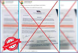
On May 10, 2021, IPRI has posted the altered map of Afghanistan along with the statistics about the latest Taliban and government controlled districts in the country. The caption of the Facebook post says: “The map shows which districts in Afghanistan are controlled by the Taliban, contested or under the Afghan government’s control”.
According to the post, roughly 19% of the districts have been attributed to be under control of Taliban at the time of Facebook post. The red color marks ‘contested control’, white color indicates government control, while the black ones shows about the Taliban control districts.
This post has been shared 60 times on Facebook.

To view the post- Facebook Post/ Archive link
The post caused outrage among the Afghan social media users saying that through this, Pakistan intends to occupy Afghanistan’s territory and disrespects its sovereignty and territorial integrity. A Facebook user has posted two altered maps of Afghanistan, the first which had been made by Russian Foreign Ministry previously, and the second one that has been published by IPRI recently. He says: “Wakhan has been attributed to Pakistan. Is this a new game?”.

The reactions of Afghan social media users can be also read on the comment section of the claim post as below.

Meanwhile, on March 14 Ministry of Foreign Affairs of Russia (MFA) had shared an altered map of Afghanistan that caused a furore among the Afghan social media users. Later on, it published a correction note saying that the interactive map of the world Earth globe as presented here is schematic and may not provide an accurate representation of national borders.
💬 #Zakharova On March 18, the special representatives of 🇷🇺 #Russia, 🇨🇳 #China, the 🇺🇸 #US and 🇵🇰 #Pakistan on the intra-Afghan settlement will meet in #Moscow. They will discuss ways to promote the intra-Afghan talks in Doha and stop the armed conflict in 🇦🇫 #Afghanistan. pic.twitter.com/s2fRKaNSmH
— MFA Russia 🇷🇺 (@mfa_russia) March 12, 2021
Fact Check
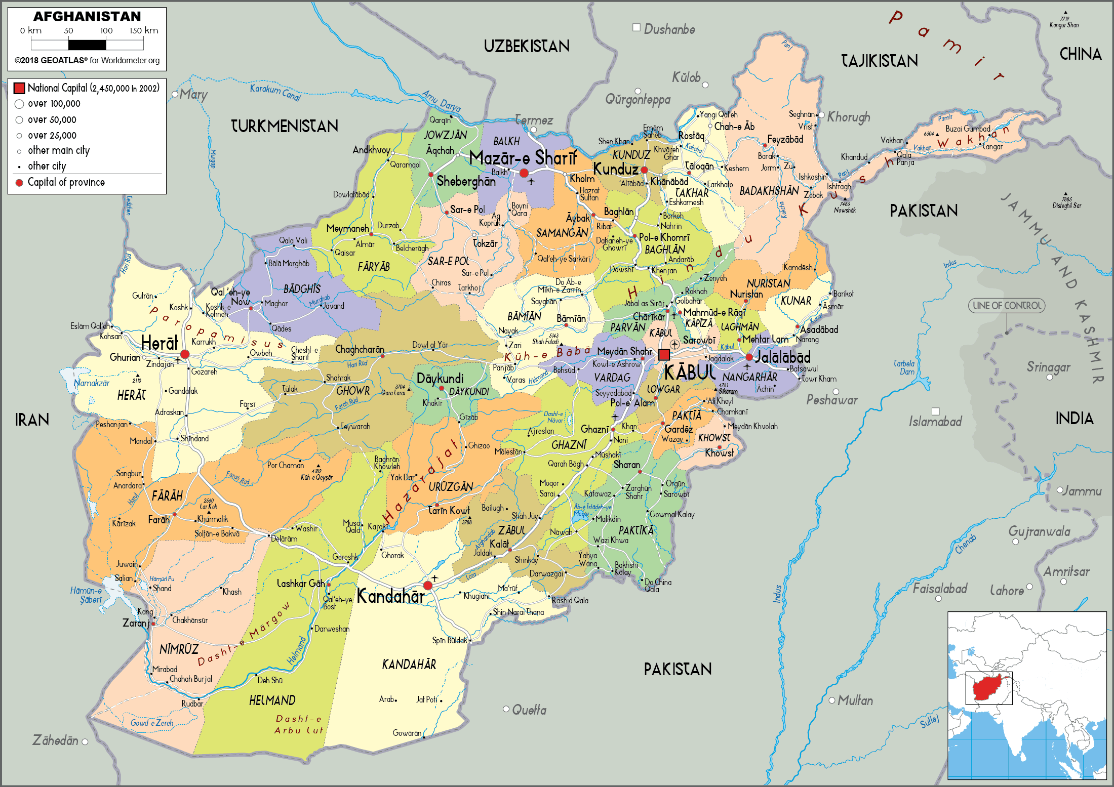
Wakhan and Pamir are integral parts of Afghanistan. Wakhan is a district of Badakhshan in Afghanistan. The Wakhan Corridor is a narrow strip of territory in Afghanistan, separating Tajikistan from Pakistan and Kashmir. The corridor, wedged between the Pamir Mountains to the north and the Karakoram range to the south, is about 350 km long and 13–65 kilometers wide, according to Wikipedia.
This can be seen in original map of Afghanistan as below.

The Wakhan corridor has acted as a buffer zone between the Russian and the British Empire in the past. The Wakhan border has been governed by the Afghans since 1893 and it intended to separate Russian Empire and British India. The border between Afghanistan and British India was determined by the then Emir of Afghanistan Abdur Rahman Khan and the Foreign Secretary of the Colonial Government of India, Sir Mortimer Durand. This border is known as the Durand line which cut through Pashtun tribal areas and villages. After the partition of British India in 1947, this border was inherited by Pakistan. Thus, Pakistan and Afghanistan share a long border, about 1,500 miles, that was drawn by the British. Here’s a map of Afghanistan and British India published in 1893. You can see the frontiers of Afghanistan extending up to present China in the east and encompassing the entire Wakhan corridor.

Source: Library of Congress
After, the Afghan war of Independence in 1919, the Durand line was accepted as the border between British India and Afghanistan with slight modifications. The map of Afghanistan that we see today was finalized after the conclusion of this war also known as Third Anglo-Afghan war after the signing of the treaty of Rawalpindi on 8th August 1919. You may also notice a significant change in the map on the North as Russian empire was overthrown in October 1917 by the Bolsheviks and replaced with Union of Soviet Socialist Republic (USSR).

Source: NAM.AC.UK
However, it is important to note that Afghanistan doesn’t recognize the Durand line as its international border and claims a significant part of Pakistan’s territory. The main reason for this is the line divides lands inhabited by Pashtuns who now stand divided between Pakistan and Afghanistan. After the independence of Pakistan in 1947, Afghanistan has been constantly demanding that the Pashtuns in Pakistan should be given a fair plebiscite to determine their fate. Despite all these issues, the fact remains that till this date Wakhan corridor is under the control of Afghanistan.
Conclusion The map of Afghanistan shared by Islamabad Policy Research Institute (IPRI) is not accurate and doesn’t match with the original map of the country. Wakhan and Pamir are integral parts of Afghanistan as seen on the original map.

Title:Islamabad Policy Research Institute Shared Incorrect Map of Afghanistan Missing Wakhan and Pamir…
Fact Check By: Fact Crescendo TeamResult: Altered

